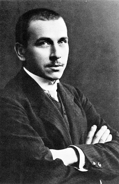
On 6 January 1912 the German
meteorologist Alfred Wegener presented a detailed theory that the continents were drifting. He postulated that there had been one
supercontinent, Pangea that had broken up about 200 million years ago.
The theory was not well received by geologists and the scientific community in
general. They believed the continents and oceans had more permanent features.
And even Wegener could not explain which forces moved the continents. He
searched for more evidence, and died on an expedition to Greenland in 1930.
Later the theory of plate tectonics, which includes continental drift, has been
almost universally accepted. His theory was basically correct. This is how
science works, when satisfactory evidence is assembled, a theory is accepted by
most scientists. It is usually a hard and time-consuming activity.
The tectonic plates move today a few
centimeters a year, and within 50 million years Africa and Australia will merge
with Eurasia forming a new supercontinent. This
new continent has already got a name - the Wegenarian cycle - in honor of
Wegener. It will take a lot of work for us human beings to prepare ourselves
for that great gathering. We need to learn more, but also have a lot of time to
do it.
Background
Other scientists like Alexander von Humboldt, A. Snider-Pellegrini and others had seen how some of the continents fit well together. They made theories that the lands around the Atlantic Ocean had once been joined. Others claimed land bridges had connected the continents but that these had sunk long ago as they thought the earth was shrinking. Wegener (1880-1930) was an astronomer and meteorologist who found evidence identical fossils of plants and animals in the different continents, see map above. Wegener’s presentation to the German geological society was the first time a comprehensive and detailed theory was made. He thought that Pangea (Greek meaning “all the earth”) had incorporated most of the landmasses of the earth. In 1937 Alexander Du Toit proposed that Pangea consisted of two main landmasses Laurasia in the north and Gondwana in the south. Laurasia consisted of North America, Europe and Asia. Gondwana incorporated South America, Africa, Arabia, India, Australia and Antarctica.
 |
|
Locations of certain
fossil plants and animals, form definite patterns
(shown by the bands of colors), if the
continents are rejoined. |
 |
| Alfred Wegener |
Background
Other scientists like Alexander von Humboldt, A. Snider-Pellegrini and others had seen how some of the continents fit well together. They made theories that the lands around the Atlantic Ocean had once been joined. Others claimed land bridges had connected the continents but that these had sunk long ago as they thought the earth was shrinking. Wegener (1880-1930) was an astronomer and meteorologist who found evidence identical fossils of plants and animals in the different continents, see map above. Wegener’s presentation to the German geological society was the first time a comprehensive and detailed theory was made. He thought that Pangea (Greek meaning “all the earth”) had incorporated most of the landmasses of the earth. In 1937 Alexander Du Toit proposed that Pangea consisted of two main landmasses Laurasia in the north and Gondwana in the south. Laurasia consisted of North America, Europe and Asia. Gondwana incorporated South America, Africa, Arabia, India, Australia and Antarctica.
 |
Pangaea began to
break up 225-200 million years ago, fragmenting into the continents as we know
them today. US Geological Survey (USGS).
|
Plate tectonics
New
knowledge in the 1960s resulted in a new theory of Plate tectonics. Today it is
estimated that Pangea was the latest
formation of supercontinents. Before that Rodinia was formed around 1 billion years ago,
and Pannotia 600 million years ago.
Then Pangea came into existence
around 270 million years ago, there was an ocean called Tethys partially
separating Laurasia and Gondwana. The only landmass which was outside Pangea
was Cathaysia comprising todays North and South China.
The breakup of Pangea started around 200
million years ago when the North American plate drifted away and the North Atlantic
opened up. Later, around 140 million years ago South America separated from
Africa, and India left Australia and Antarctica. Then 80-30 million years ago
North America separated from Europe. There was an opening between North and
South America. India moved north and clashed with Asia forming the Himalayan
mountains around 50 million years ago.
The Ocean currents were different than
today, meaning that water was streaming between Africa and Eurasia and between
North and South America.
Earth during the early Tertiary Period
Continental plates and hot-spots
Plate boundary and relation to volcanoes
 |
|
Volcanic activity and the
Earth’s tectonic plates. Encyclopædia Britannica, Inc.
|
I am open to your comments and
proposals. You may send me a message on bjarte.bjorsvik at hotmail.no
Warmly
Bjarte Bjørsvik


Ingen kommentarer:
Legg inn en kommentar